Leddy Park, Burlington, Vermont
Situated in the New North End of Burlington, Leddy Park is a waterfront recreation area with naturalized social trails, sports fields, courts, and an ice arena. This park was never formally, fully, conceptualized. The land itself was originally used as an industrial site for meat processing up until it was acquired by the city and transitioned into public space. The land's history has its added barriers in reconceptualization, such as chemical caps that exist beneath the parking lots’ surface, as well as legacy utility lines and runoff from pre-existing surrounding housing developments.
Phase One
My initial introduction to the comprehensive replanning of Leddy Park was through an upper-level class at the University of Vermont, Ecological Landscape Design. This studio-based class worked with the Burlington Parks, Recreation and Waterfront department to dream of a new Leddy without bureaucratic boundaries. The question was, what are objectively the best solutions to the parks' inherent barriers without getting lost in the logistics of red tape?
Design Goals
Goals of this site were focused mainly around ecological issues including: reducing runoff/erosion into the lake, offsetting impervious surface expansion, and forest health restoration. Additionally, I saw room for expansion of multi-generational community space, circulation continuity, and developing points of interest around the bike path.
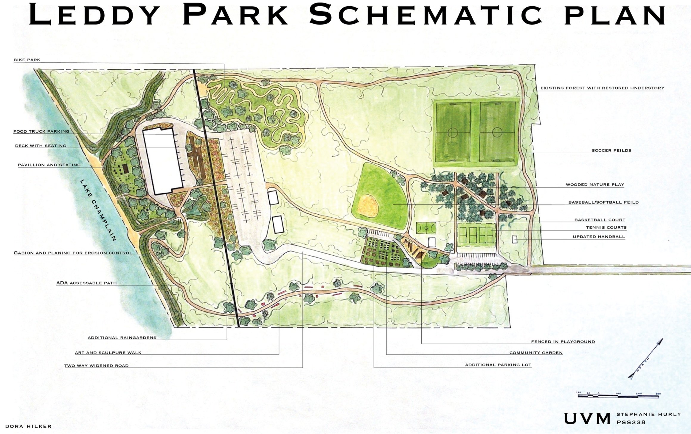
Ecological issues can be seen addressed in the implementation of additional rain gardens with native plantings, gabion installation along steep slopes, understorey plantings in forested areas, re-routing impervious roads and replacing them with pervious solutions. social goals were addressed through starting a community garden, adding two play areas geared towards children, building a waterfront pavilion, condensing driving entry/exit drives into one route, and turning social paths into ADA accessible trails.
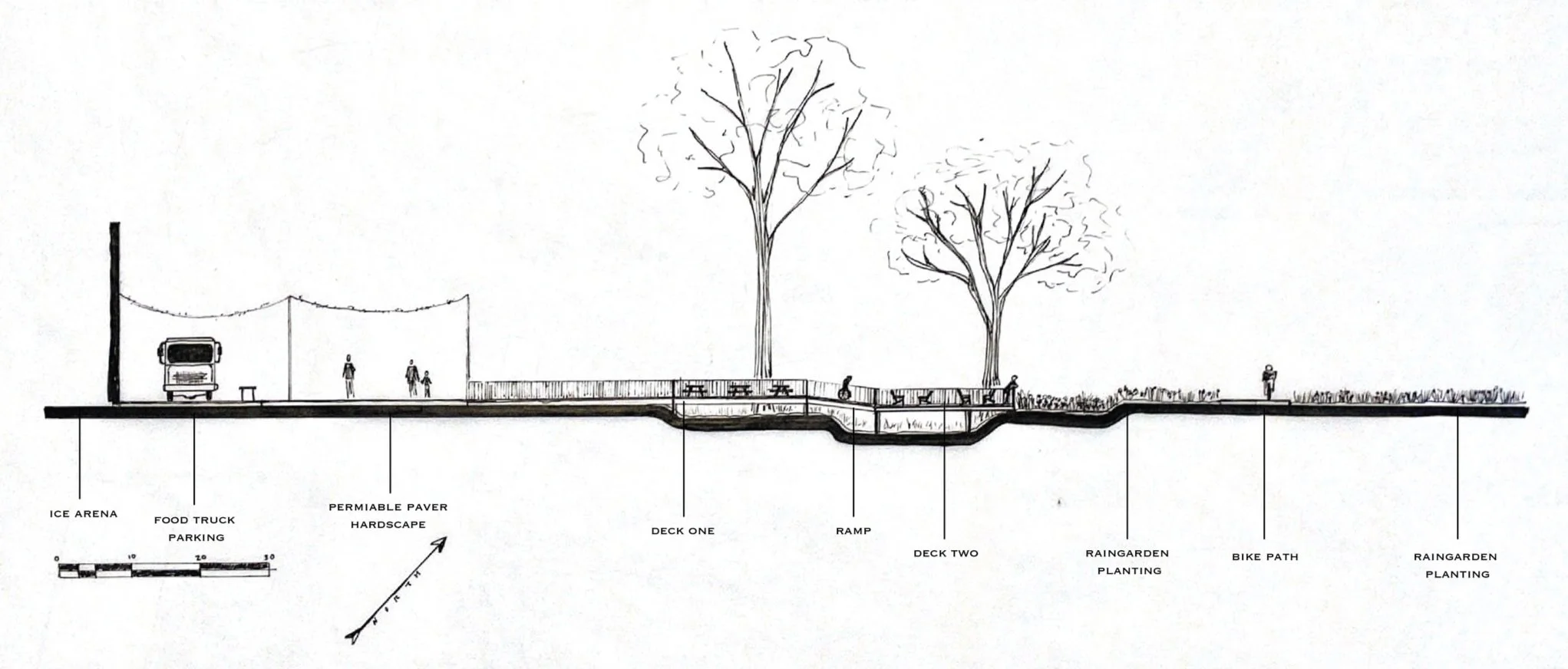
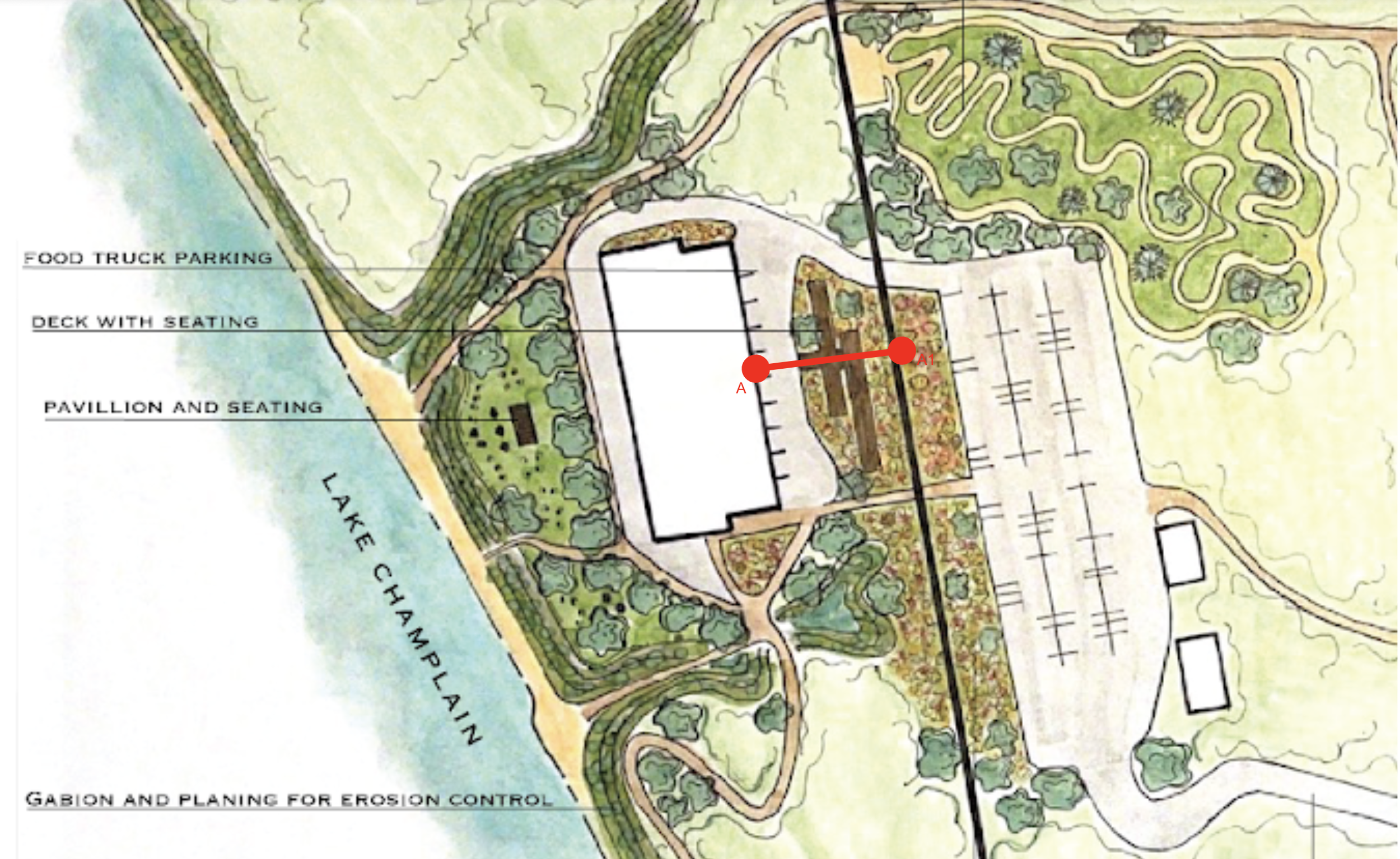
Section Drawing
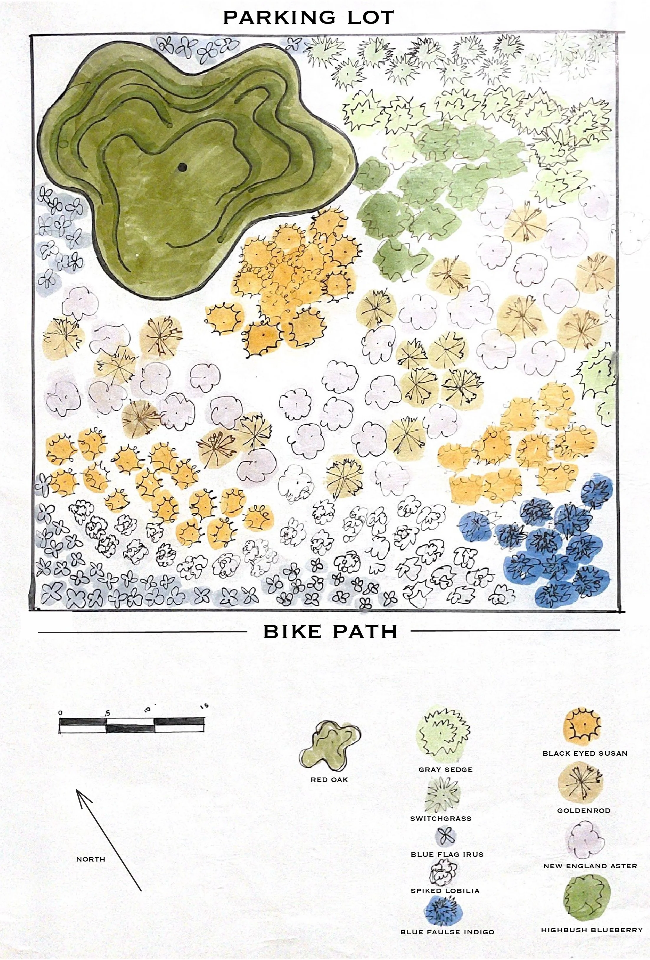
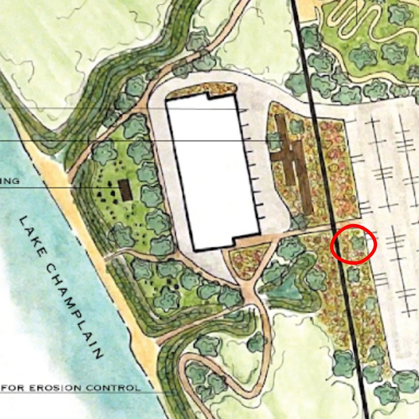
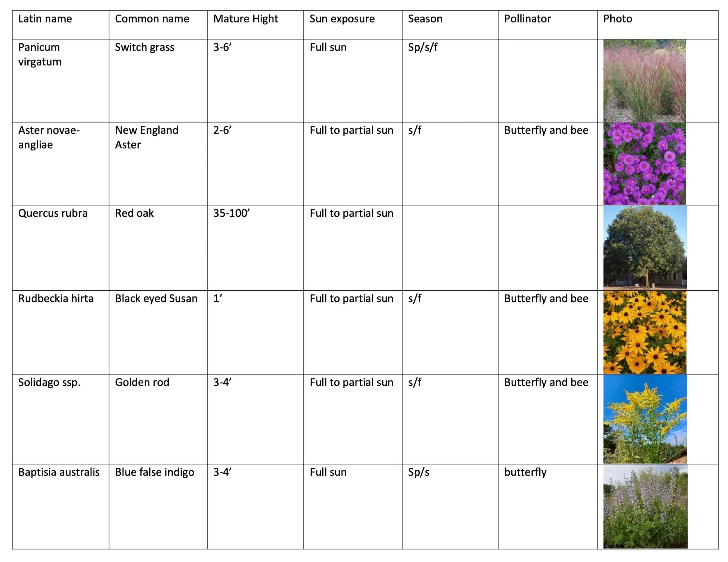
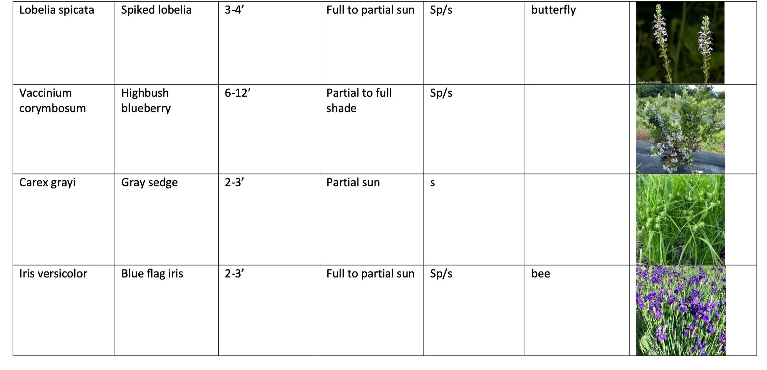
Native, Water Tolerant, Planting Plan
Phase Two
In May of 2022, I interned with the Burlington Parks, Recreation, and Waterfront Parks Planning Department. During my year of holding this internship, I continued working on the Leddy Park comprehensive re-design. The deeper we dove into this project, the more we and our contractors realized further land history was needed to inform sustainable design. I began working on an in-depth ecological and social site analysis.
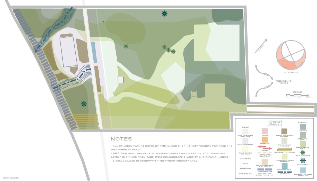
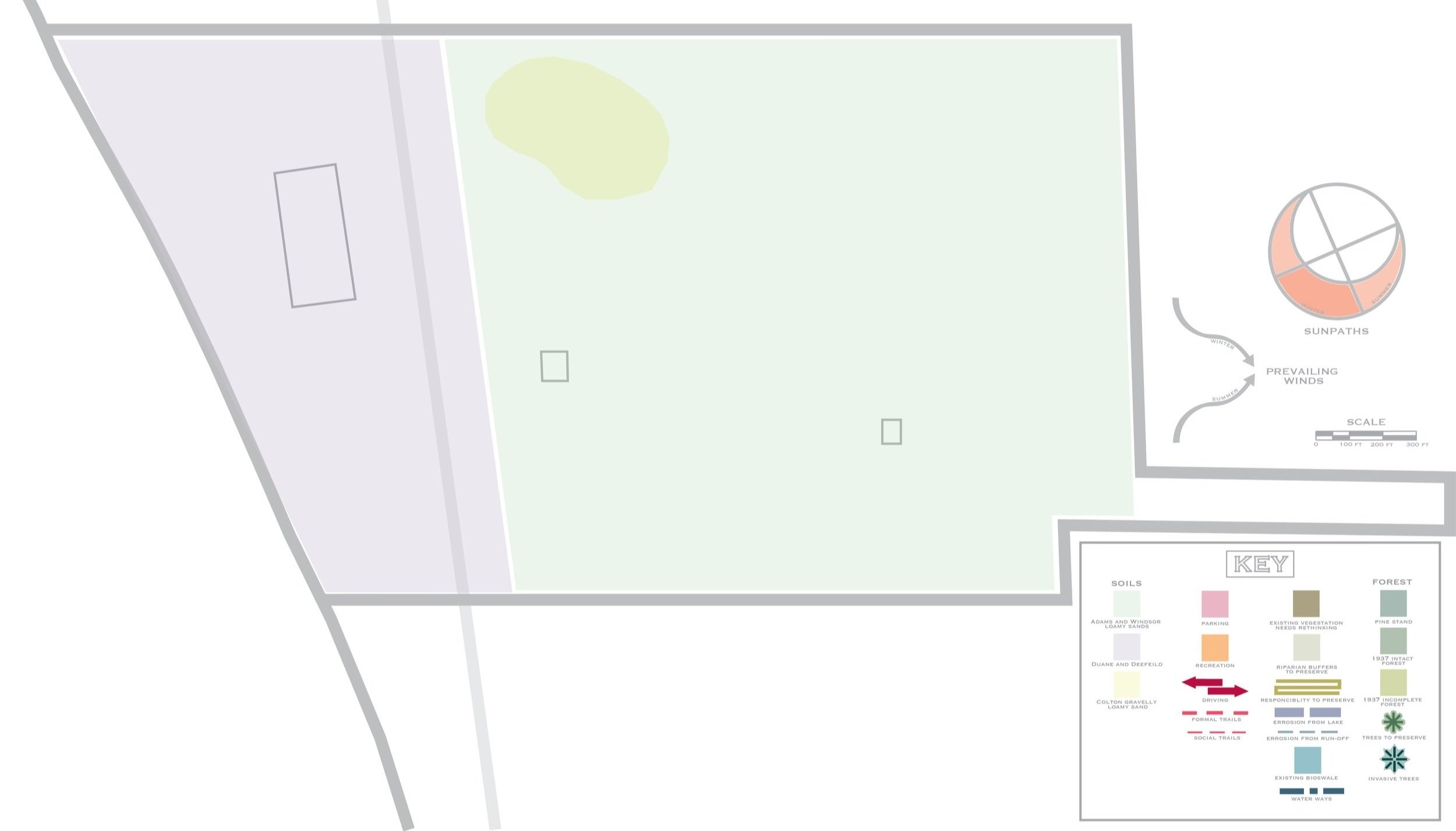
Above is a compilation of all the data collected and contextualized. As one can see, there is a lot going on! Leddy proved to be a site with a complex and intersectional history. Vermont’s Agency of Natural Resources (ANR) listed the entirety of Leddy Park as an “overall priority for Vermont conservation design at the landscape level,” which, in its simplest forms, sets the tone for the importance of focus on ecological health. With data collected from Geographical information systems (GIS) logs and historical reports provided through the BPRW department. The broken-down maps are listed below!
1937


Site Ecology
Leddy’s ecology proved to be a large question mark. Elements that needed addressing, such as erosion and run-off, as well as locations for further development, were heavily impactes existing ec’s existing ecology. This initial analysis led to a formal environmental survey and impact report, finding the exact locations of rare habitats.
Recreation
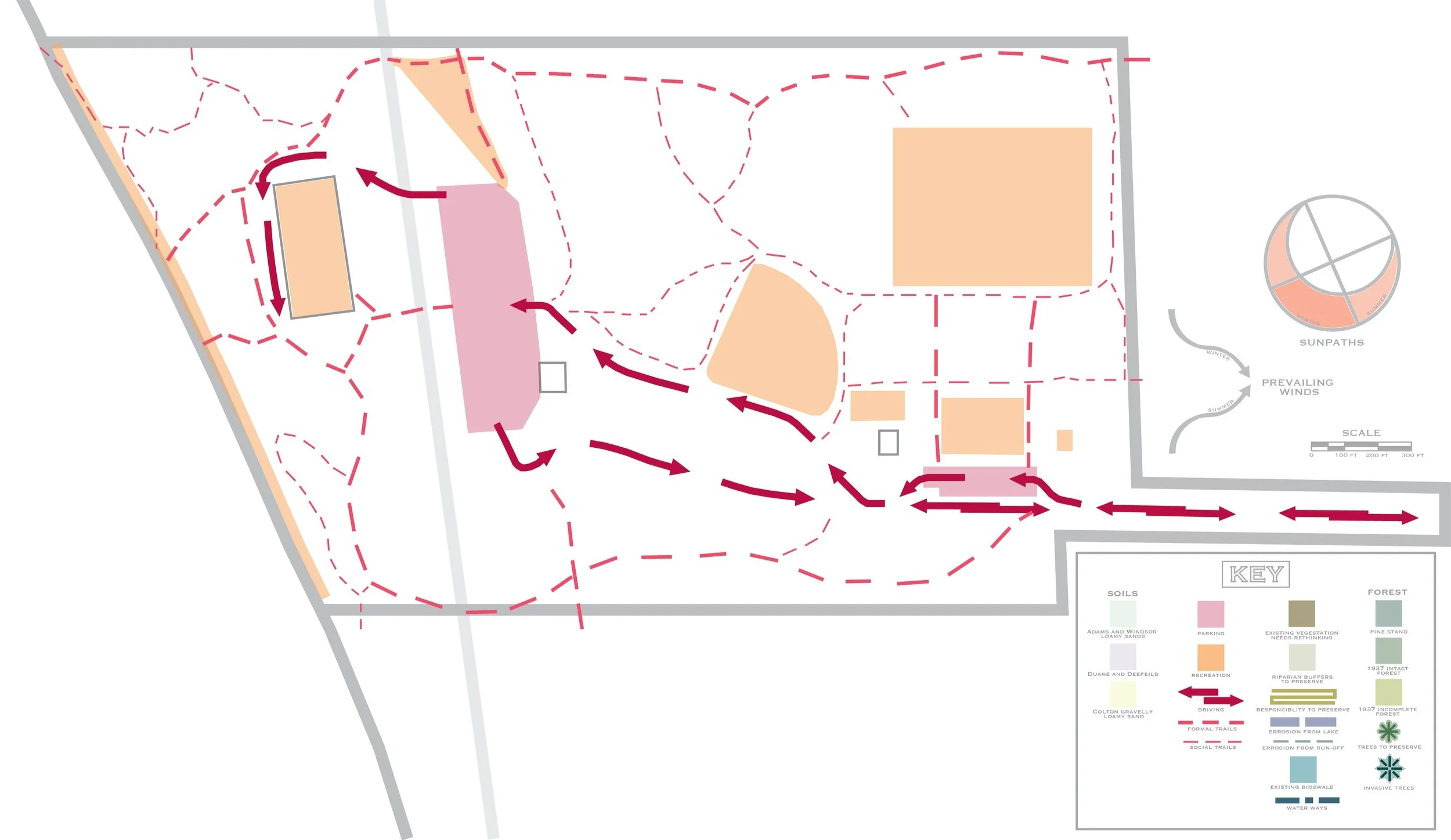
Recreation and its circulation points directly to the park’s historical industrial use. Dual driveways for trucks, spread-out recreation areas, and social trails as opposed to formal trails. This map was intended to highlight the need for circulation continuity in re-design.
Forest Legacy
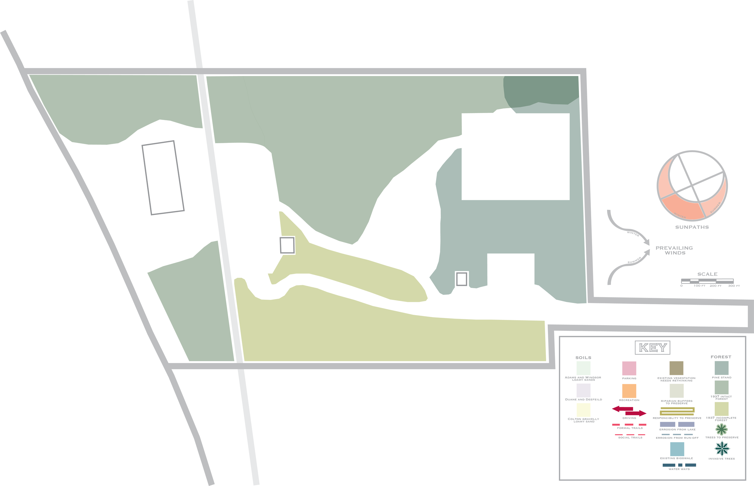
The question of a historically intact forest was a major point of curiosity. Through analyzing early GIS photography from 1937, I could discern where intact forests existed at that time and the general age of said vegetation. The darkest green area on the map symbolizes a mono-culture pine stand that was planted in the 1970s. The larger, mid-green section symbolizes a forest that was intact in 1937 (meaning this swath of trees is likely around 200 years old), with the lighter green section symbolizing an incomplete forest in 1937.
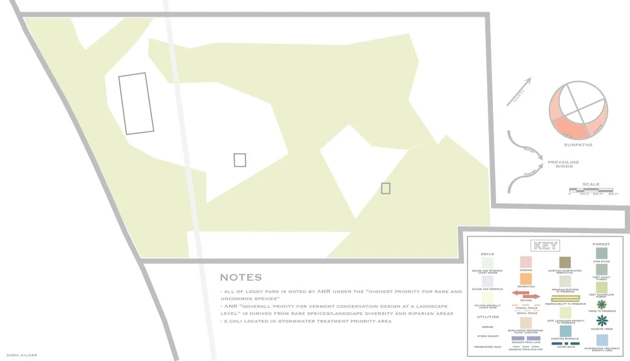
Areas of Need for Conservation per VANR
Soil Types per USDA Soil Survey
Project Updates
Parks took this research and applied it to the project. A comprehensive ecological analysis was conducted, surveying the land to look for ecological anomalies, and rare habitats and species scattered along the lake's coast were found. Additionally, 200+ year old trees were found, as well as enough information to conclusively rule out sections of the park for elements like the impending Bike Park or pavillion. The following steps included surveying the public for design input, giving the new information, and sourcing information about how to proceed with construction mindfully. As it stands now, a local design firm has completed the park’s comprehensive plan, and incremental changes are being made as funding becomes available.